|
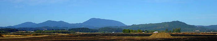
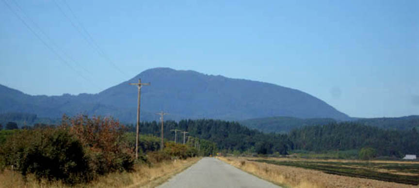
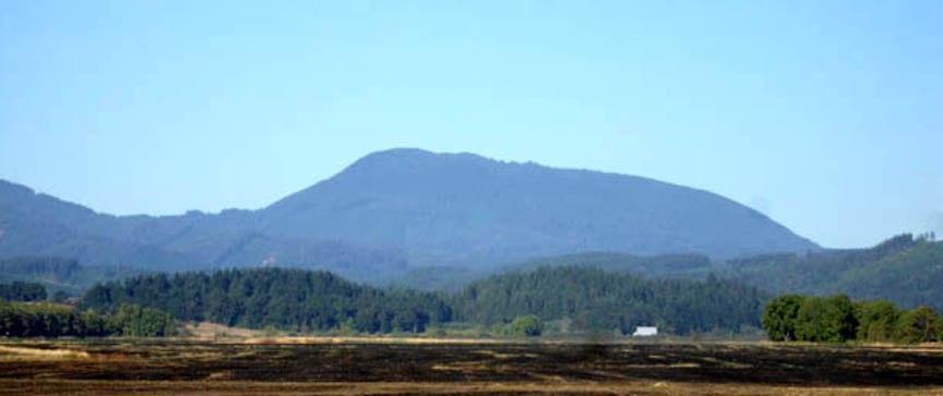
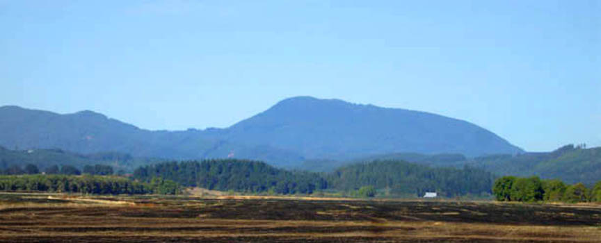
Mary's Peak, Philomath, Oregon, USA
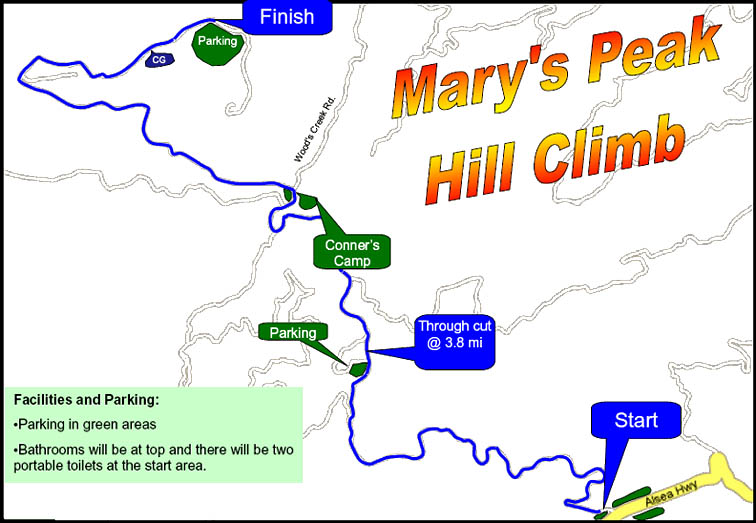
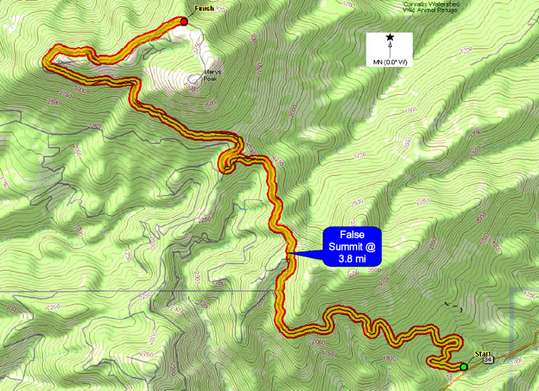
At 4097ft (1249m) above sea level, Mary's Peak is the tallest mountain in the Oregon Coast Range. The 9.3 mile climb is on the wide smooth Mary's Peak Rd., taking cyclists past beautiful vistas of the Willamette Valley. The snow capped peaks of the Cascades to the east are often visible. The climb starts at the up slope curb-cut/edge of "upper" (right) parking lot of Mary's Peak Rd. (1228 ft). The finish is 9.3 miles later at the end of the double yellow center line at the entrance of the top parking lot (3782 ft). Mary's Peak in the snow.
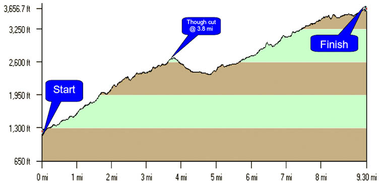
Mary's Peak presents cyclists with several grades of climbing (and even descending) on the 9.3 mile trek to the top.
The first 2.2 miles present a tough grade that varies between 8% and 11%. The grade then relaxes a bit for the remainder of this first 3.8 mile climb, 1458ft gain for an average grade of 7.5%. After passing the “through cut”, a false summit at 3.8 mi, the road descends for about 1 mile. Climbing starts again at 4.8 miles. The remaining 4.7 miles to the top, 1407ft gain, are at an average grade of 5.7% with several short descents near the top.
There is one flat 150 ft gravel section at about 5 miles. This section is regularly rutted and "wash-boarded" with loose gravel and potholes. It is typically smoother towards the center in the car tracks. This is a flat section, so you won't be descending through it at speed (on the way up), but you may want to slow down on the descent to avoid flatting and loss of control.
Be prepared! It is typically a little cool in the early AM, but a nice temperature for climbing. Descending in the early AM and in the evening is often cold (bring a windbreaker & gloves). If it is cloudy or rainy, it can be be downright miserable descending.
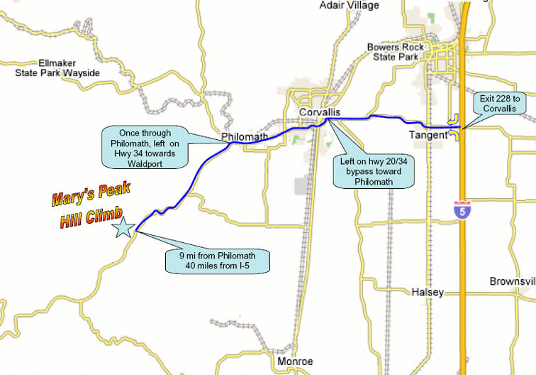
You can see Mary's Peak's distinctive form from I-5 (less than 20 miles to the west), take exit 228 west towards Corvallis (do not go into town unless you need to). At the golf course, turn left at the light heading west towards Philomath/Ocean Beaches on Hwy 20/34. On the west side of Philomath, turn left at the mill onto Hwy 34 heading to Waldport. Drive 8.6 miles and look for parking marshals as you emerge from the “twisties”.
This information is modified from

|